Image: ESRI
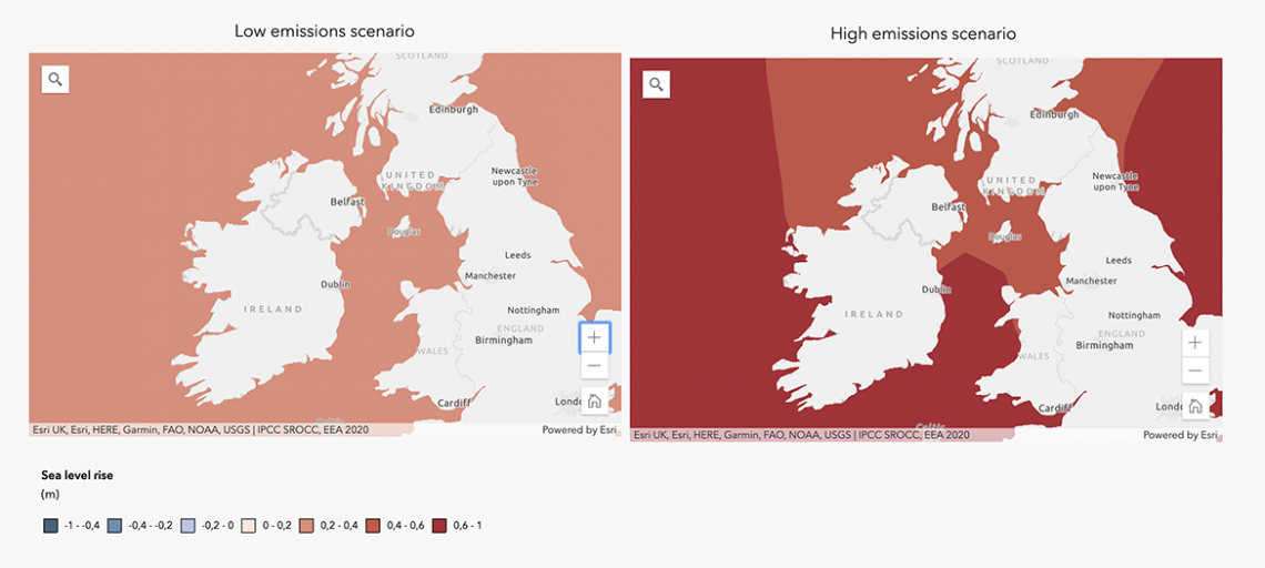
ESRI published a set of Climate Change Impact maps for Europe using their ARCGIS software. The maps show comparisons between low emmissions and high emmissions scenarios for sea levels, droughts, income for farmers, flooding and fires.
Source:


